

21/05/2026
Under the Capital Master Plan with a 100-year vision, Hanoi has established a new development model consisting of 9 growth poles, 9 major urban centers, and 9 development corridors, creating a long-term spatial development framework.
According to Decision No. 2512 signed and promulgated by Chairman of the Hanoi People’s Committee Vu Dai Thang, the Capital Master Plan with a 100-year vision covers the entire administrative boundary of Hanoi, with a total area of approximately 3,359.84 square kilometers.
Hanoi’s spatial development orientation is organized around ring roads, radial transport corridors, and an interconnected regional urban system. In particular, the development corridors serve as the “backbone” connecting growth poles with the central urban area and the Capital Region network.
This is Hanoi’s longest-term master plan to date, setting development orientations through 2085 and beyond. Through this plan, Hanoi aims to restructure its urban system and redistribute population and infrastructure.
9 Major Urban Centers
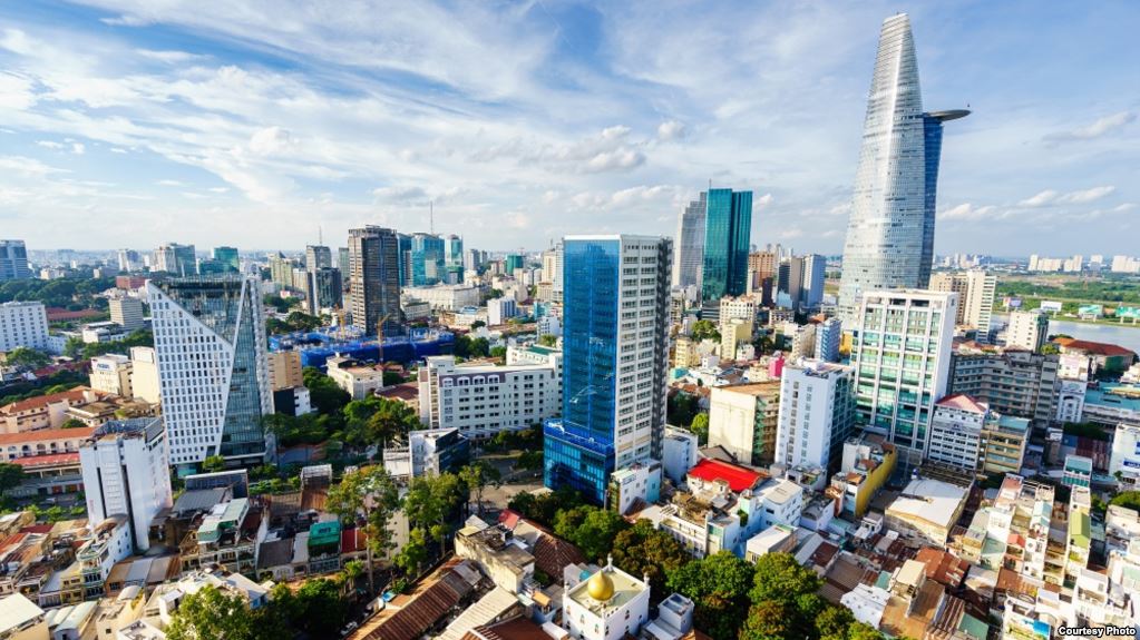
According to the master plan, Hanoi will develop 9 major urban centers based on the scale, characteristics, roles, and outstanding advantages of each area.
- The Southern Red River Urban Center will function as the political, administrative, cultural, heritage, financial, and commercial-service core. This area will also develop international integration functions, healthcare, tourism, science and technology, education and training, and logistics services.
- The Northern Red River Urban Center is planned as a hub for economic activities, services, and international economic integration.
- The Eastern Urban Center will focus on commercial and service development, international integration, healthcare, tourism, logistics, and education and training.
- The Sports Urban Center will serve national and international sporting activities.
- The Phu Xuyen Urban Center will become a logistics, healthcare, and high-tech industrial hub in southern Hanoi.
- The Van Dinh – Dai Nghia Urban Center is planned to develop under a heritage urban model, combining spiritual-cultural tourism, eco-service tourism, and traditional craft villages.
- The Xuan Mai Urban Center will develop toward education and training, ecological landscapes, and tourism services.
- The Hoa Lac Urban Center will continue to promote science and technology, innovation, education and training, and healthcare, centered around the Hoa Lac Hi-Tech Park and Vietnam National University, Hanoi.
- The Son Tay Urban Center is planned as a cultural, heritage, education, healthcare, and ecological urban area.
Son Tay is envisioned as a cultural and heritage urban center.
9 Growth Poles
The Capital Master Plan establishes 9 growth poles to create new development momentum for Hanoi. The central growth pole includes the historic inner city and expanded areas on the right bank of the Red River, maintaining its role as the administrative, financial, and cultural core of the Capital.
- The Northern Growth Pole, covering the former Dong Anh – Me Linh – Soc Son area, will serve as a key integration driver. The area is planned to develop into an urban hub for services, international trade, finance, and logistics associated with Noi Bai International Airport, a free trade zone, and high-tech industrial centers.
- The Eastern Growth Pole, located in the former Gia Lam – Long Bien area, will develop regional-scale commercial complexes, inland container depots (ICD), and modern logistics centers connected to National Highway 5 and the Hanoi – Hai Phong Expressway, linking Hanoi with the eastern economic growth triangle of Hai Phong and Quang Ninh.
- In the south, the Phu Xuyen – Ung Hoa area is planned as an industrial and logistics growth pole associated with Hanoi’s second southern airport, high-speed rail, and river ports.
- The Southwestern Growth Pole (covering the former Xuan Mai – Chuong My area) is envisioned as an education, training, and healthcare urban zone combined with eco-resort development.
- The Western Growth Pole (Hoa Lac) will become a science and technology, innovation, and education urban center, along with a free trade zone, connected to the western provincial development corridor including Phu Tho and Son La.
- The Northwestern Growth Pole (Son Tay – Ba Vi urban area) is planned as a historical-cultural urban zone and eco-tourism destination associated with national forests, Tan Mountain – Da River landscapes, and national defense and security functions. It will also connect with Vinh Yen, Vinh Phuc, and Viet Tri – Phu Tho urban areas.
- The Red River Growth Pole will feature a unique multi-functional landscape space, serving as a cultural, financial, commercial-service, and tourism center, as well as a new development driver for the Capital.
9 Development Corridors Connecting the Entire Capital Region
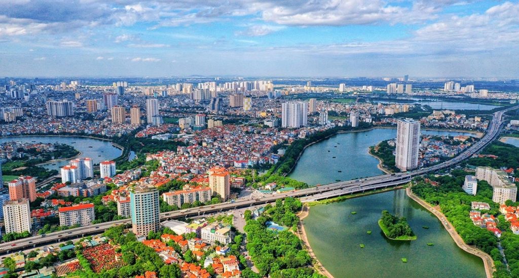
Under the new master plan, Hanoi identifies 9 strategic development corridors that connect growth poles and major urban centers with the inner city and the regional network.
- The Nhat Tan – Noi Bai / Bac Thang Long – Noi Bai Corridor serves as the backbone for the formation of the northern urban area, an important international gateway, and a symbol of Hanoi’s modernization and integration.
- The West Lake – Co Loa – Gia Binh Airport Corridor connects central Hanoi with the new northeastern economic zone and Gia Binh Airport in Bac Ninh Province. Along this corridor, innovative urban areas, financial centers, high-tech hubs, and premium service zones will be developed.
- The National Highway 5 / Hanoi – Hai Phong Expressway Corridor is oriented as a strategic route connecting Hanoi with seaports and the international port system. The corridor will develop under a smart urban model integrating services, commerce, and logistics.
- The National Highway 1A / Phap Van – Cau Gie Expressway Corridor is the primary economic corridor connecting Hanoi with southern economic networks and coastal regions. The city plans to concentrate supporting industries, logistics, and multimodal transport development along this route.
- The National Highway 21B / National Highway 21C Corridor, besides reducing traffic pressure on National Highway 1A, will also serve as a unique green and cultural axis. It connects a heritage chain including the Thang Long Imperial Citadel, Temple of Literature, Ba Sao, Huong Tich, and Bai Dinh.
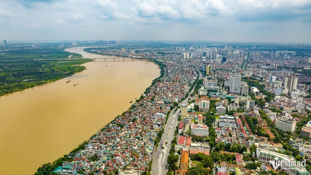
The Red River landscape boulevard is considered the strategic axis of the entire master plan.
- The National Highway 6 / Ha Dong – Xuan Mai Corridor will develop a chain of eco-urban areas connecting central Hanoi with Xuan Mai Urban Area and the northwestern gateway region.
- The Thang Long Boulevard / West Lake – Ba Vi Corridor connects central Hanoi with the western growth pole, including Hoa Lac Urban Area and Ba Vi region. In addition to serving as a driver for the knowledge economy in science, technology, and education, this corridor is also a cultural-landscape axis linking Thang Long culture with the Xu Doai region.
- National Highway 32 / Tay Thang Long Route is an important radial corridor connecting the central area with Son Tay Urban Area and the upper Red River – Phu Tho region. Areas along the corridor are planned for tourism, services, and historical-cultural urban development.
- The Red River Landscape Boulevard is the strategic axis of the entire master plan, functioning both as a central green space and as an economic, commercial-service, and creative urban corridor along both banks of the Red River.
According to Hanoi’s orientation, the Red River corridor will become a symbolic space representing the Capital’s image of “Civilized – Identity – Creative,” aiming to become a new symbol of the modern metropolis in the future. The corridor will also connect provinces along the Red River, forming a distinctive economic-ecological landscape region in northern Vietnam.

 Zalo
Zalo Webchat